Lake Achensee’s Mountaineering Village
Steinberg am Rofan is a member of the Mountaineering Villages, an initiative committed to sustainable and gentle development incorporating local communities and its people. The village, also called “the most beautiful end of the world" by the locals, lies on a high plateau that branches off from the Achental near the German border. Steinberg enjoys an idyllic location surrounded by the peaks of the Guffert (2,194m), Unnutz (2,075m) and the walls of the mountains Rofanspitze, Rosskopf, Seekarlspitze, Spieljoch and Hochiss.
Good to know
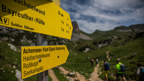
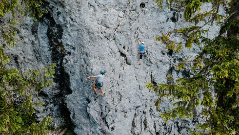
Steinberg’s backyard mountain, the Guffert, is one of the most beautiful panoramic mountains in the region. In 1911, Hans Dülfer and Hans Fiechtl made the first ascent of the southern edge of the Guffert. Many other famous mountaineers took to the rope for some alpine adventure in Steinberg, among them Hermann Buhl, Mathias Rebitsch and Peter Habeler. Steinberg is also a stage finish of the Eagle Walk, the long-distance hiking trail through Tirol. A worthwhile excursion for hikers is the Ampmoosalm which enjoys a beautiful setting under the northern walls of the Seekarlspitze und the Rosskopf. Another highlight is the cave of historic inscriptions at the foot of the Schneidjoch, which still poses a mystery to researchers.
The church is the centre of the community. Steinberg is a place of natural beauty where you can connect to nature. “We strive to maintain the natural balance in the ecosystem. Our main attractions are beautiful natural places and a stunning mountain scenery in a pristine landscape,” says mayor Helmut Margreiter. “Being a member of the Mountaineering Villages offers Steinberg the opportunity to develop tourism in a sustainable way while maintaining our values and at the same time strengthening our community. Our goal is to connect culture and tourism, while preserving our identity and thus enriching the lives of both visitors and residents.” Being open to new possibilities is an important step in this process. Therefore, the people of Steinberg work on joint projects with the Mountaineering Village of Kreuth and evaluate how to improve public transport and local supply.
Facts & figures:
- Elevation: 1,015m
- Highest point: Hochiss 2,229m
- Population: 286 (in 2020)
- Mountains: Brandenberg Alps, Mangfall mountains
- Alpine Association: DAV section Kaufering
Public transport: From the train stations Jenbach or Schwaz by public bus to Steinberg a.R. (change in Maurach and Achenkirch) or from the train station Tegernsee by public bus to Steinberg a.R. (change in Achenkirch). For bus timetables, visit www.vvt.at.

