Experience beautiful autumn colours!

The best hikes in late summer or autumn

One of the best ways to discover a landscape is on foot. And, according to a study by the Austrian Alpine Association, hiking can boost your mood, replenish your energy, and restore a sense of calm.

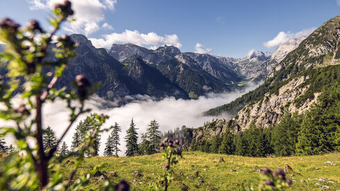
Hiking is a great outdoor activity at any time of the year. But for many, autumn is the best season for exploring the forests and mountains. The leaves change colour, the temperatures are cooler, and the views are incredibly clear. Nature shines in hues of amber, red and gold, and the forests are ablaze with brilliant displays of colour - a real feast for the eyes.

Of course, a stop for refreshments is a must on a hiking or mountain tour. Numerous alpine huts in the Rofan and Karwendel mountains invite you to relax and enjoy regional delicacies while you soak in the magnificent views of the surrounding mountains. Fancy a scenic gondola ride? Let the Karwendel and Rofan cable cars whisk you to the top of the mountains. The cable cars operate until the beginning of November, weather permitting.

Activity
Family-friendly hiking trail
Mountain tour
Themed walks
Elevation Gain
0 - 6.200 hm
6.200 - 12.400 hm
12.400 - 18.600 hm
18.600 - 24.800 hm
24.800 - 31.000 hm
Difficulty
Easy
Medium
Hard
reset filter
list view | map
🞞

Maurach - Buchau - Dalfazer Wasserfall - Dalfaz Alm - Maurach

Starting Point: Maurach, Atoll Achensee

This tour starts from opposite the tennis court near the Atoll Achensee. Walk through the underpass…

🏀
walking time
04:00 h
🔖
distance
9.2 km
🜏
elevation gain
760 hm
🞽
difficulty
Medium
🞞

Maurach - Dalfaz Alm - Dalfazer Wasserfall - Maurach

Starting Point: Maurach, valley station of the Rofan cable car

From the valley station of the Rofan cable car, follow the path past the hotel Naturhotel Alpenblick…

🏀
walking time
04:30 h
🔖
distance
10.5 km
🜏
elevation gain
840 hm
🞽
difficulty
Medium
🞞

Maurach - Durrawand - Dalfaz Alm - Schützensteig - Buchauer Alm – Maurach

Starting Point: Maurach, valley station of the Rofan cable car

From the valley station of the Rofan cable car, follow the path past the hotel Naturhotel Alpenblick…

🏀
walking time
04:30 h
🔖
distance
10.2 km
🜏
elevation gain
790 hm
🞽
difficulty
Medium
🞞

Achenkirch - Koglalm - Seekaralm - Seekarspitze - Achenkirch

Starting Point: Achenkirch, Sixenhof local history museum

From the car park of the Sixenhof local history museum, follow the forest path via the Seebauer…

🏀
walking time
07:00 h
🔖
distance
13.9 km
🜏
elevation gain
1130 hm
🞽
difficulty
Hard
🞞

Achenkirch - Zöhreralm - Adlerhorst - Achenkirch

Starting Point: Achenkirch, car park Sonnberg (biomass cogeneration plant)

From the car park Sonnberg at the biomass cogeneration plant, a forest path leads to the Zöhreralm…

🏀
walking time
03:00 h
🔖
distance
7.7 km
🜏
elevation gain
410 hm
🞽
difficulty
Easy
🞞

Achenkirch - Zöhreralm - Hochunnutz - Vorderunnutz - Achenkirch

Starting Point: Achenkirch, car park Sonnberg (biomass cogeneration plant)

From the car park Sonnberg at the biomass cogeneration plant, walk to the Zöhreralm mountain hut…

🏀
walking time
07:30 h
🔖
distance
15 km
🜏
elevation gain
1280 hm
🞽
difficulty
Hard
🞞

Pertisau - Besinnungs-Dien-Mut-Weg St. Notburga (path of reflection) - Rodlhütte - Pertisau

Starting Point: Pertisau, car park Besinnungsweg

From the Seehotel St. Hubertus, the trail climbs gradually past the 18 stations of the…

🏀
walking time
01:30 h
🔖
distance
3.8 km
🜏
elevation gain
200 hm
🞽
difficulty
Easy
🞞

Steinberg - Schneidalm - Raetische Inschriften - Gufferthütte - Steinberg

Starting Point: Steinberg am Rofan, Parkplatz Waldfrieden

From the car park “Waldfrieden”, follow the main road for ca. 500 metres in the direction of…

🏀
walking time
08:00 h
🔖
distance
18.1 km
🜏
elevation gain
1060 hm
🞽
difficulty
Medium
🞞

Maurach - Eben - Wiesing-Erlach - Maurach

Starting Point: Maurach, village centre

From the Maurach village centre walk along the village road to the church “St. Notburgakirche” in…

🏀
walking time
03:00 h
🔖
distance
8.8 km
🜏
elevation gain
290 hm
🞽
difficulty
Easy
🞞

Wiesing - Wiesinger Bühel - Bühelkreuz - Erlach - Wiesing

Starting Point: Wiesing, parish church

From the parish church Wiesing, follow the village road to the primary school. After the…

🏀
walking time
01:15 h
🔖
distance
3.1 km
🜏
elevation gain
110 hm
🞽
difficulty
Easy

You may also be interested in

e-biken-falzthurn-gramai-karwendel-achensee.jpg
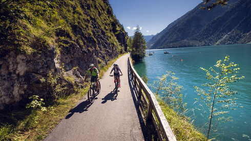
E-Biking at Lake Achensee
radfahren-mtb-achensee-achenkirch-ufer.jpg
Long-distance cycle route munich venice
sportklettern-grauwand-achensee-2.jpg
Autumn activity holidays