Eagle Walk Stage 15: Solsteinhaus Lodge - Leutasch/Ahrn
Important Infomation
Elevation Profile
Description
trail description: From Solsteinhaus Lodge, follow signage to Eppzirler Notch (“Eppzirler Scharte”) and/or Eppzirler Alpine Pasture Hut (“Eppzirler Alm”). First, a waymarked path leads across the wide open Alpine meadows of Erlalm Alpine Pasture. Thereafter, the path continues across scree, talus and rugged terrain over to the beginning of the scree cirque and upward to Eppzirler Notch. On the climb across the cirque, the path forks; follow signed (“Eppzirler Scharte”) track no. 212. Climbing steeply, the trail furiously works its way up to the notch located between Kuhlochspitze Peak and Erlspitze Peak. Beyond, walk on a well-maintained path across Kuhloch scree cirque, which is steep on its top and then becomes wide and shallow. From here, the path zigzags down and merges into lush Alpine meadows at an elevation of approximately 1700 metres. After another short steep ascent with scree, you finally reach the Alpine valley floor. From here, the path gently descends and leads to Eppzirler Alm Alpine Pasture Hut, running parallel to the (desiccated) streambed.
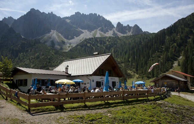
From the pasture hut, you leisurely descend on a broad roadway across grazing pastures to Eppzirler Tal Valley and continue in the same direction heading towards the entrance of the valley. Pass the branch-off to Oberbrunnalm Alpine Pasture Hut (elev. 1,200m) and continue on the gently descending path that leads out of the valley. The roadway now runs along Gießenbach Creek (alternately on the left and right side of the creek) into Gießenbach Gorge. The gorge is wooded at the outset and is then becoming rockier and rockier. After the gorge, the path leads to the parking area for Eppzirler Alm Alpine Pasture Hut in Gießenbach (a hamlet of Scharnitz). Cross the railway tracks and the main road. In the village, take the first road to the right heading towards Scharnitz. Then, turn left towards Hoher Sattel Saddle (“Hoher Sattel”). Further on, proceed in the direction of “Bogenschiessstand” and/or “Scharnitz” and branch off to the left towards “Leutasch”. Then, bear right onto a forest road towards “Leutasch über hohen Sattel”. After this short level portion in Gießenbach, the forest road ascends with moderate steepness and then leads gently up through thinning forest to Sattelklamm Gorge. From the end of the road, a path runs along the slope through groves and climbs vigorously in its middle section. The path turns onto a trail. Follow signage to “Leutasch/Ahrn” until you reach Hoher Sattel Saddle. Beyond the saddle, a (partly rather steep) forest road through thinning forest takes you down to Leutasch/Ahrn and to Leutascher Ache Bridge across Satteltal Valley. Do not branch off to the left straight before the destination end.