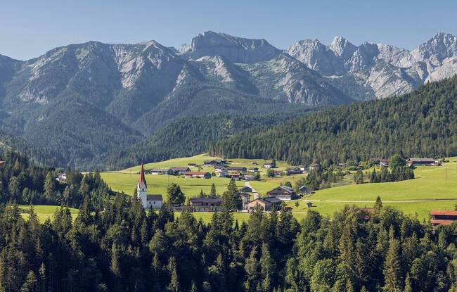
Steinberg - Gfaßsattel - Schönjochalm - Steinberg
Important Infomation
🔖
Route Length
13.1 km
🜏
Elevation Gain
330 hm
🞍
Highest Point
1287 hm
🔲
Elevation Loss
330 hm
Time Uphill
02:15 h
Time Downhill
02:00 h
🏀
Route Time Total
04:15 h
🞽
Difficulty
Easy
Starting Point: Steinberg am Rofan, parish church
End Point: Steinberg am Rofan, parish church
Route Type: Roundtrip
Elevation Profile

Description
From the parish church Steinberg, walk in a westerly direction past the Messnerhof and continue along the dirt path to the Obermooshof. Walk behind the farm and follow the road to the barn. Turn right and follow the road as it climbs to a junction. Turn left and follow the gravel path straight on to the Gfaßsattel (1,226 metres). From here, follow the gravel path and the forest path to the Schönjochalm (1,287 metres, see signpost). The return route is via the forest road to Steinberg.