Pertisau - Falzthurnalm - Gramai Alm - Pertisau
Important Infomation
🔖
Route Length
14.1 km
🜏
Elevation Gain
280 hm
🞍
Highest Point
1263 hm
🔲
Elevation Loss
280 hm
Time Uphill
02:15 h
Time Downhill
02:15 h
🏀
Route Time Total
04:30 h
🞽
Difficulty
Easy
Starting Point: Pertisau, car park Karwendeltäler
End Point: Pertisau, car park Karwendeltäler
Elevation Profile


Description
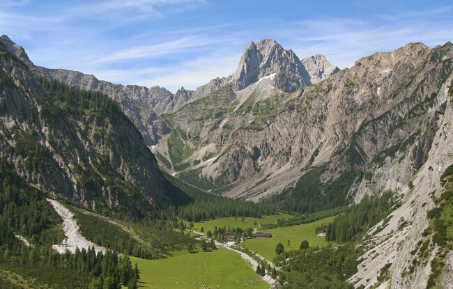
From the toll booth at the entrance to the Karwendel valleys in Pertisau, walk to the end of the car park. Turn left and follow the asphalt footpath to the Falzthurnalm mountain hut (time ca. 1 hour). From here, a hiking trail takes you through alpine meadows to the Gramai Alm mountain hut. The return is via the same route.
The path is suitable for wheelchairs and pushchairs from Pertisau to the Falzthurnalm.