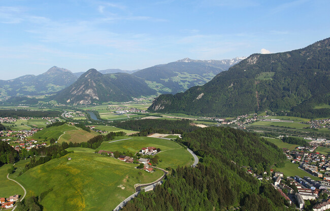
Panorama-Restaurant Kanzelkehre - Wiesing - Panorama-Restaurant Kanzelkehre
Important Infomation
🔖
Route Length
6.6 km
🜏
Elevation Gain
325 hm
🞍
Highest Point
896 hm
🔲
Elevation Loss
325 hm
Time Uphill
01:30 h
Time Downhill
01:15 h
🏀
Route Time Total
02:45 h
🞽
Difficulty
Easy
Starting Point: Wiesing, car park Panorama-Restaurants Kanzelkehre
End Point: Wiesing, care park Panorama-Restaurants Kanzelkehre
Elevation Profile
Description
From the car park of the Panorama-Restaurant Kanzelkehre, walk along the main road for a few metres until you reach the signpost “Wiesing/Erlach”. Follow the forest path which affords splendid views of the Inn- and Zillertal until you come to an asphalt road. Turn right and walk past house number 227. Walk through the underpass of the Achensee main road and continue along the village road until you arrive at the parish church Wiesing. The return is via the same route, or by bus.