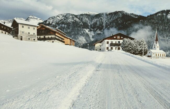
Kleine Steinbergrunde
Important Infomation
🔖
Route Length
3.8 km
🜏
Elevation Gain
90 hm
🞍
Highest Point
1070 hm
🔲
Elevation Loss
90 hm
🏀
Route Time Total
01:00 h
🞽
Difficulty
Easy
Starting Point: Steinberg am Rofan, parish church
End Point: Steinberg am Rofan, parish church
Route Type: Roundtrip
Elevation Profile


Description
The tour starts from the parish church. Walk past the Dorfhaus and above the Messnerhof, turn right into the winter hiking trail in the direction of Rofan lifts II. Follow the route past the Silberwaldhütte mountain hut and walk in the direction of the Rofan lifts I. Above the ski lift pillar, follow the trail to the stream, walk across the bridge and finally you arrive at the village cross-country ski trail. Walk along the trail for a little until you reach the car park of the cross-country skiing centre. From here, turn right and follow the road to the junction of the federal road. Turn right and walk in the direction of the starting point parish church/Dorfhaus.