Eben - Astenau Alpe - Ebner Joch - Eben
Important Infomation
🔖
Route Length
7.6 km
🜏
Elevation Gain
970 hm
🞍
Highest Point
1957 hm
🔲
Elevation Loss
970 hm
Time Uphill
02:30 h
Time Downhill
02:00 h
🏀
Route Time Total
04:30 h
🞽
Difficulty
Medium
Starting Point: Maurach, car park Notburgaheim
End Point: Maurach, car park Notburgaheim
Elevation Profile


Description
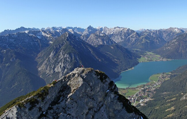
From the car park above the residential and nursing home in Eben, walk across the Achensee main road and follow the signpost “Zur Astenau Alpe”. Climb through the sparse pine forest and follow the trail as it meanders uphill to the Astenau Alpe, where you will be rewarded with splendid views of the Inntal valley. A steep section leads past the mountain hut to a junction. Follow the steep trail as it climbs by way of switchbacks between mountain pines up to the summit. The return is via the same route.