Eagle Walk Stage 18: Lorea Hütte - Anhalter Hütte
Important Infomation
Elevation Profile

Description
trail description: Start off at Lorea Hut and follow signage to “Loreakopf” on a trail that gently ascends rolling Alpine pastures in the beginning. At the fork, turn left on the signed “Loreakopf” track and climb up to Loreascharte Notch, mainly across scree and on a vigorously steep path in the upper part. On the other side, steeply descend on a singletrack trail through a grass flank down into Heimbachtal Valley. At the base of the descent, bear left on the valley floor and head towards “Nassereith”. Now, a narrow singletrack trail along the stream (in one section right in the streambed) gently descends out of the valley. At the point where the valley sharply bends to the right, change to the right bank of the stream; pay attention to the marking on the rock on the right side. From here, the trail enters the woods and descends south-westward into Tegestal Valley where it turns onto a forest road (the path joins the road at an altitude of around 1,400 meters above sea level). The forest road gradually climbs into the valley, passing the branch-off to Heiterwand Hut (to the left). Always stay in Tegestal Valley, which is very gentle in this section. Walk into the wide open Alpine pastures and leisurely ascend Schweinsteinjoch Col (elev. 1,564m) where the route to Sinnesbrunn branches off. The Eagle Walk, however, proceeds in the same direction across the gentle Alpine pastures, descending to Hintere Tarrentonalm Alpine Pasture Hut (elev. 1,519m).
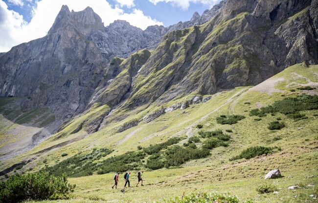
Here, follow signage to Anhalter Hut and climb up leisurely on a broad forest road. Shortly after, turn left at the fork and walk along the creek. The route passes Schafer Hut and then turns onto a singletrack trail. Now, in open terrain below Heiterwand Face, follow the leisurely ascending singletrack trail until you reach Hinterberg Col (elev. 2,202m). From there, make your way down across a steep tussock slope (“Schwarze Erde”, literally ‘Black Earth’), traverse the cirque and walk on a plain singletrack trail over to Kromsattel Saddle. From here, gently descend across Alpine pastures and meadows to quaint Anhalter Hut, situated at an elevation of 2,040 metres on foot of jagged Heiterwand Face.