456 Eng-Binsalm
Important Infomation
🔖
Route Length
3.4 km
🜏
Elevation Gain
310 hm
🞍
Highest Point
1500 hm
🔲
Elevation Loss
310 hm
🞽
Difficulty
Hard
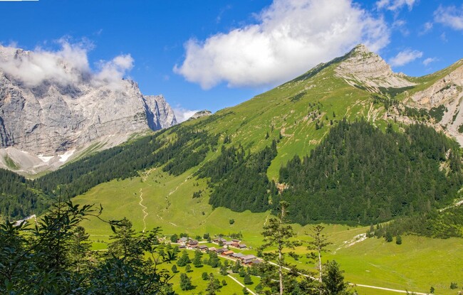
Starting Point: Großer Ahornboden, car park Eng at the Naturhotel DIE ENG
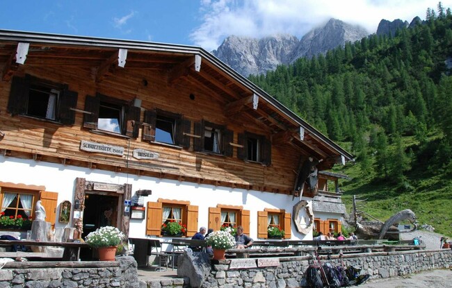
End Point: Binsalm
Elevation Profile
Description
From the car park Eng in the rear Risstal valley, the tour leads over asphalt through the alpine village in the Eng. First, the route travels over meadows before it follows the forest road to the Binsalm (1,502 metres). The return is via the same route. If you want to go higher, leave your bike behind and walk to the Lamsenjoch to the west. Continue to the Lamsenjochhütte mountain hut (1,953 metres) and enjoy beautiful panoramic views of the rugged Karwendel mountains.