Steinberg - Schneidalm - Raetischen Inschriften – Stubachalm - Steinberg
Important Infomation
🔖
Route Length
15.1 km
🜏
Elevation Gain
965 hm
🞍
Highest Point
1705 hm
🔲
Elevation Loss
965 hm
Time Uphill
04:00 h
Time Downhill
03:45 h
🏀
Route Time Total
07:45 h
🞽
Difficulty
Medium
Starting Point: Steinberg am Rofan, Parkplatz Waldfrieden
End Point: Steinberg am Rofan, Parkplatz Waldfrieden
Route Type: Roundtrip
Elevation Profile


Description
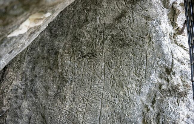
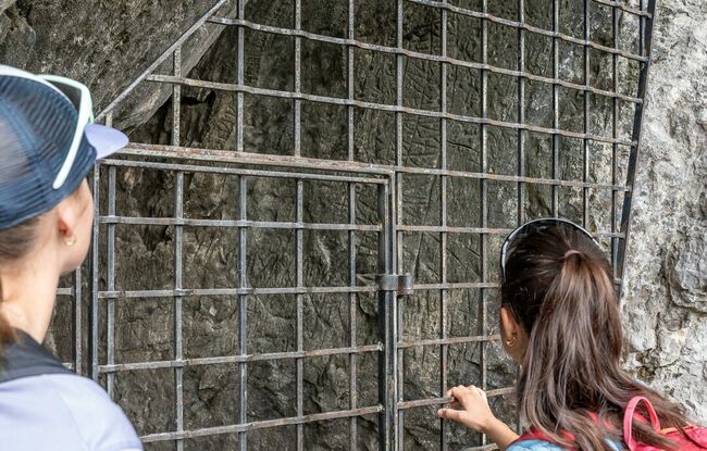
From the car park “Waldfrieden”, follow the main road for ca. 500 metres in the direction of Achenkirch until you reach the forest road to the right. From here, walk along the Weißenbach in the direction of the Weißbachl Alm (not serviced). A beautiful trail takes you to the Schneidalm (not serviced) and the Rhaetian inscriptions. Turn right and follow the trail in the direction of the Angernalm. Keep right and climb to the Schneidjoch (see signpost). Walk over the Schneidjoch saddle facing the Guffert and descend in the direction of the Issalmen (not serviced). Walk past the Issalmen and continue in a westerly direction via the Stubachalm (decrepit) until you reach the federal road. Walk back to the starting point.