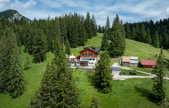
Steinberg - Gufferthütte - Steinberg
Important Infomation
🔖
Route Length
18.1 km
🜏
Elevation Gain
1060 hm
🞍
Highest Point
1625 hm
🔲
Elevation Loss
1060 hm
Time Uphill
04:00 h
Time Downhill
04:00 h
🏀
Route Time Total
08:00 h
🞽
Difficulty
Medium
Starting Point: Steinberg am Rofan, Parkplatz Waldfrieden
End Point: Steinberg am Rofan, Parkplatz Waldfrieden
Elevation Profile


Description
From the car park “Waldfrieden”, follow the main road for ca. 500 metres in the direction of Achenkirch until you reach the forest road to the right. Form here, walk along the Weißenbach in the direction of the Weißbachl Alm (not serviced). A beautiful trail takes you to the Schneidalm (not serviced) and the Rhaetian inscriptions. From here, follow the trail to the Ludernalm (not serviced) and continue to the Jägeralm (not serviced). Continue along the forest road to the Gufferthütte (1,475 metres). The return is via the same route.