Eagle Walk Stage 05: Gasthof Buchacker - Pinegg
Important Infomation
Elevation Profile

Description
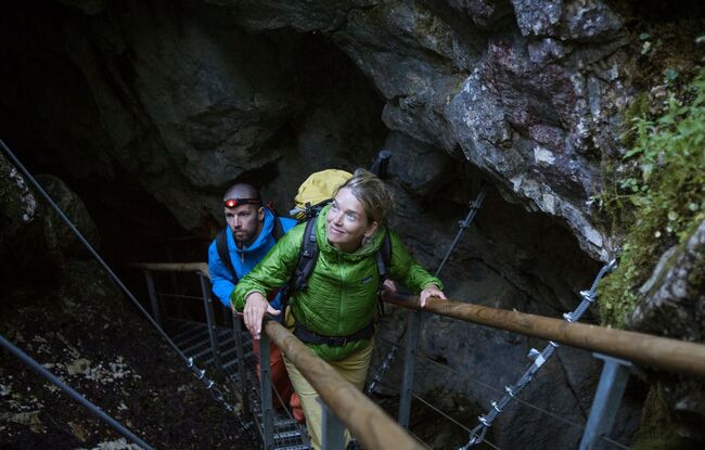
trail description: From Buchacker Mountain Inn it is a gentle downhill stroll along a forest road until you reach a turnoff. Bear right towards “Hasatal” and continue walking. At the next fork aim left and head up, then right onto a signed (“Nachbergalmen”) track. Climbing steeply, the trail works its way up Nachberg Hochleger and across wide open Alpine pastures to Ascherjoch Col at an elevation of 1,458 metres. This is where your vertical adventure is just beginning, taking you up, up, up atop 1,743-metre Plessenberg Peak, assisted by a fixed anchoring system of cables, steps and ladders. Catch your breath and scan the horizon. Savour one of the finest vantages for admiring rugged and lofty Kaiser Mountain Range. And if you can ever move your eyes away from these mesmerizing mountains, a multitude of others demand your attention as well, from the Kitzbühel Alps and Rofan Range to Zillertal and Stubai Alps. If the weather is clear, you’ll even have views of Großglockner and Großvenediger Mountains. Walk down to Heubergsattel Col and bear right towards Kienberg. The trail works its way up to the summit of Kienberg Peak through dwarf pine fields. At an elevation of 1,786 metres, this is the highest point on this walk. And from the highest elevation, the only way is down: Keep heading down along wide open Alpine pastures, passing Einkehralm and Heubrandalm Alpine Pasture Huts, with a short, steep plunge from “Prama” to Pinegg at the end. Enjoy dinner at Gwercherwirt Inn and call it a day, surrounded by the awesome beauty of Brandenberg Valley.