Pertisau - Tristenautal - Pertisau
Important Infomation
🔖
Route Length
6.5 km
🜏
Elevation Gain
125 hm
🞍
Highest Point
1100 hm
🔲
Elevation Loss
125 hm
🏀
Route Time Total
01:45 h
🞽
Difficulty
Easy
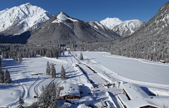
Starting Point: Pertisau, car park Karwendeltäler (cross-country skiing centre)
End Point: Pertisau, car park Karwendeltäler (cross-country skiing centre)
Route Type: Roundtrip
Elevation Profile

Description
This loop trail starts at the cross-country skiing centre at the entrance to the Karwendel valleys in Pertisau. Turn left and walk in the direction of the Falzturnalm mountain hut. Turn left after ca. 100 m and follow the trail through the Tristenautal valley. At the end of the trail, you will be back in Pertisau close to the valley station of the Karwendel cable car.